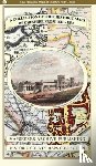
A Cheshire 1611 - 1840 - Fold Up Map that features a collection of Four Historic Maps, John Speed's County Map 1611, Johan Blaeu's County Map of 1648, Thomas Moules County Map of 1840 and Cole and Roper's Plan of the City of Chester 1805.
€29.50
Nights at the Circus
Robbins, Ruth
€13.45
Proposal Writing for Government Contracts
Corbett, H Roger
€60.30
The Last of Her Kind
Nunez, Sigrid
€19.95
The Numbers Game
Anderson, Chris, Sally, David
€20.45
Nederlands - Pashto (gekuiste versie)
€25.00
Lehrkräfte führen, fördern und fordern
Heißenberger, Petra
€66.10
Dylan for Harmonica
Dylan, Bob
€22.45
Channel Codes
Ryan, William E. (Zeta Associates), Lin, Shu (University of California, Wilson, Stephen G. (University of Virginia)
€112.30
Pinborough, S: We Live Here Now
Pinborough, Sarah
€37.40
Caricature and the Irish
Robinson, Nicolas K.
€51.65
A Nation of Counterfeiters
Mihm, Stephen
€50.10
365 Gays of the Year (Plus 1 for a Leap Year)
Laney, Lewis
€26.50
After Appomattox
Downs, Gregory P.
€30.40
Death's End
Liu, Cixin
€18.25
Easter Bugs: A Springtime Pop-Up by David A. Carter